
Whoitam Image Measurement is special for measuring cadastral maps and cadastral surveys. Because in traditional method, land parcel areas are determined graphically in the field. The method is not very accurate, but even so it seems difficult to find another way in the present circumstances and working conditions with heavy time constraint. The use of planimeters, measuring the area by coordinates and other area calculation methods requires huge work and time. But Whoitam Image Measurement provides you accurate and time-saving measurements. A number of simple and user-friendly tools help you to measure length, area, draw, identify boundaries and merge your images.
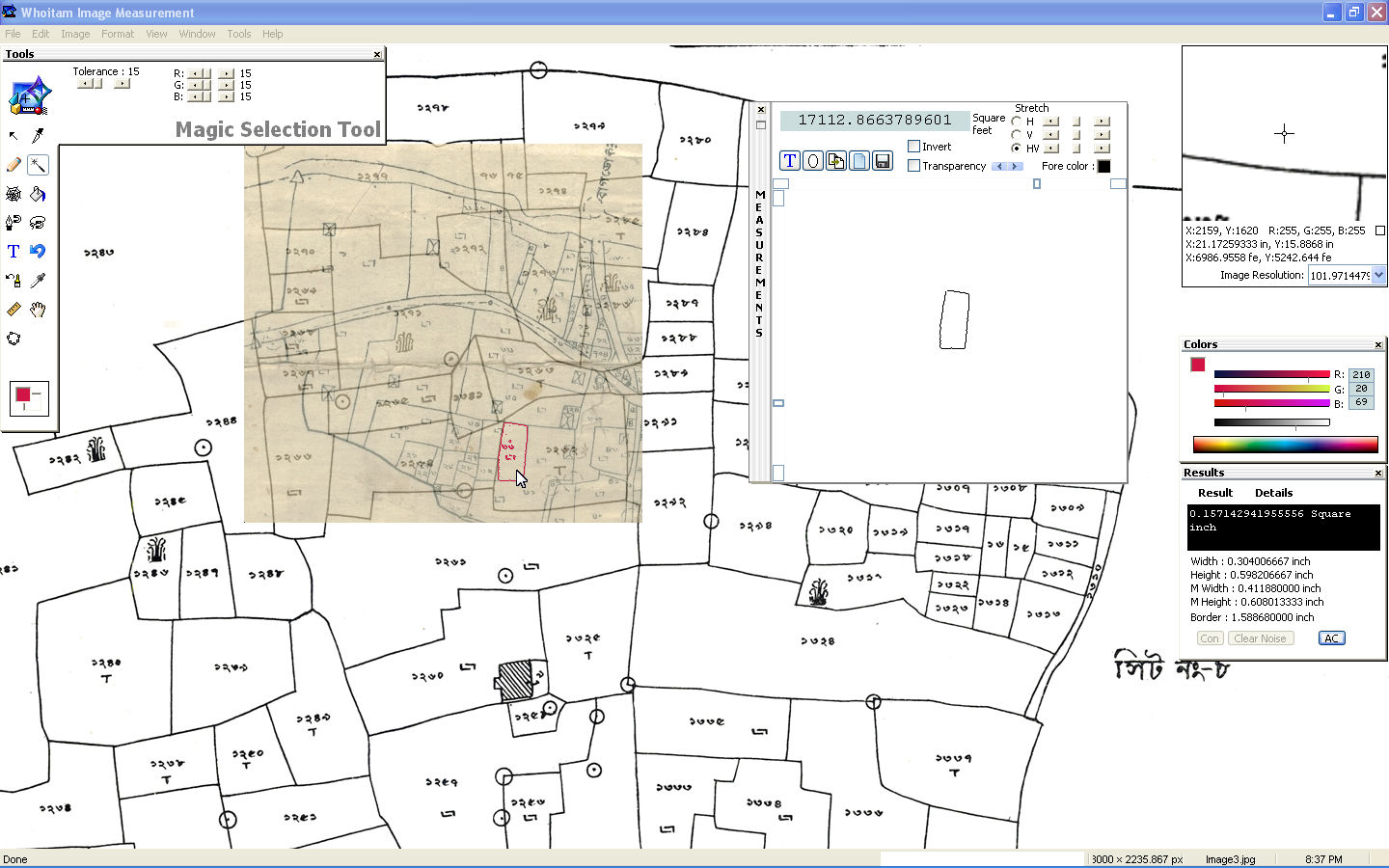
Magic Selection Tool
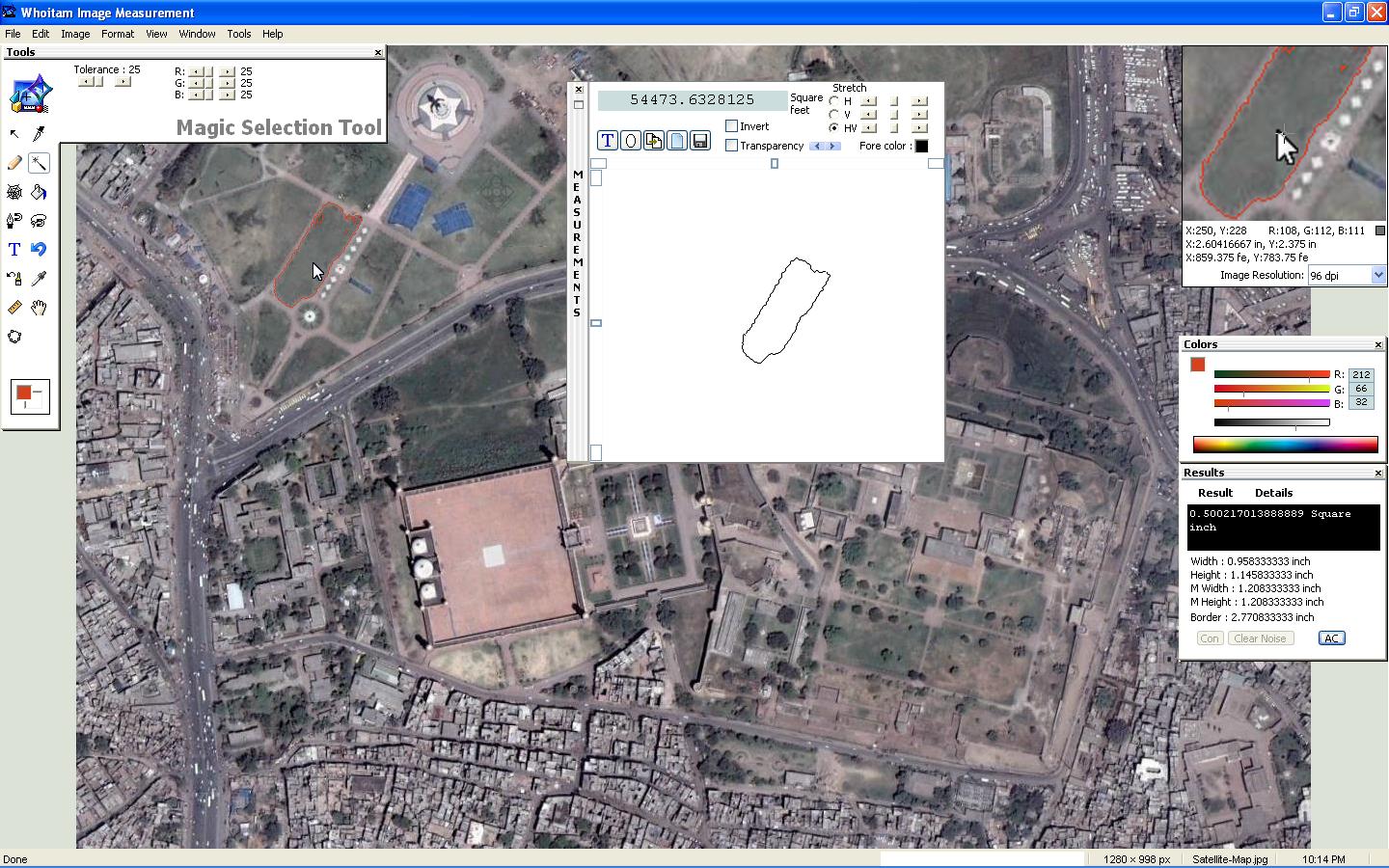
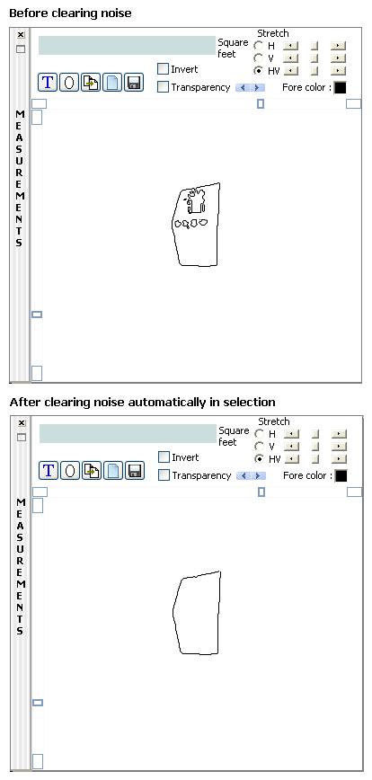
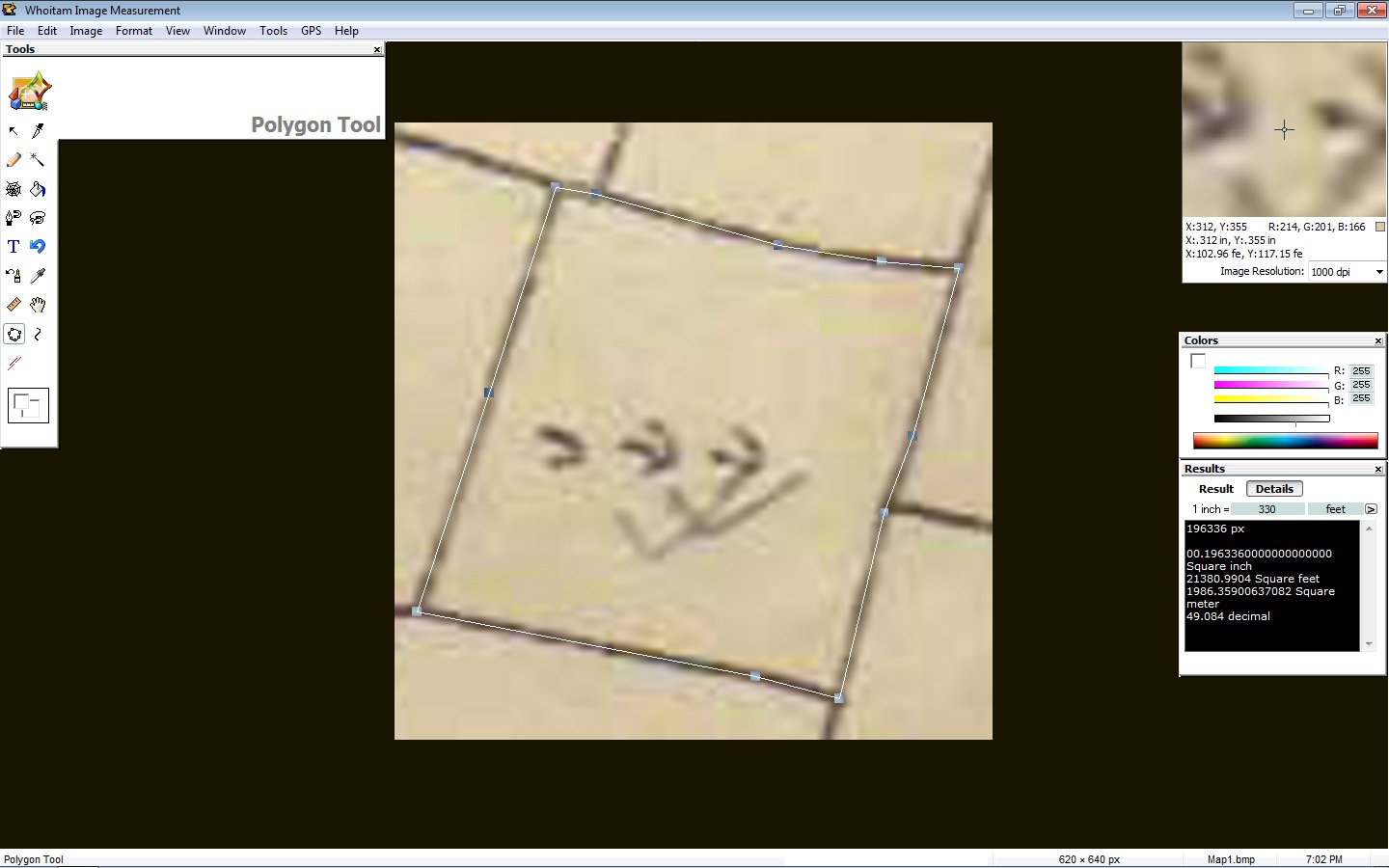
The measurements may be done by pointing and clicking or with the magic selection tool which automatically detects edges on objects in the images. It can select any irregular shaped region. Then you can clear noise automatically in selection that reduces the area. You can also get area by polygon tool. Whoitam Image Measurement can load different types of images. Include medical images. Angle, distance, perimeter, area, point and line measurements may be done by using the tools in the Tools Palette. The tools are designed to be easy to use tool for measuring digital images.
Automatic calibration
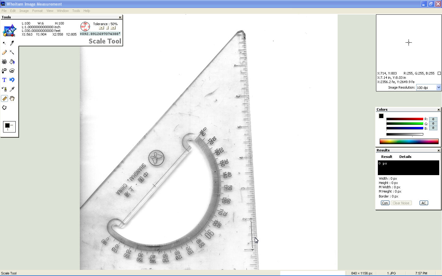
Automatic calibration is available to provide real world dimensional measurements such as inches, meters, feets, decimals etc. For example, draw a line of 1 inch length on a real paper. Scan it and load in Whoitam Image Measurement. Then measure it by scale tool. It will show 1 inch. No calibration is required. Again print it by Whoitam Image Measurement. On real paper it will show 1 inch length again. The measurements are drawn over a measurement layer, so the original image is not altered in any way. They can be copied and pasted to any other program. You can draw and process images programmatically with script.
Polygon Tool
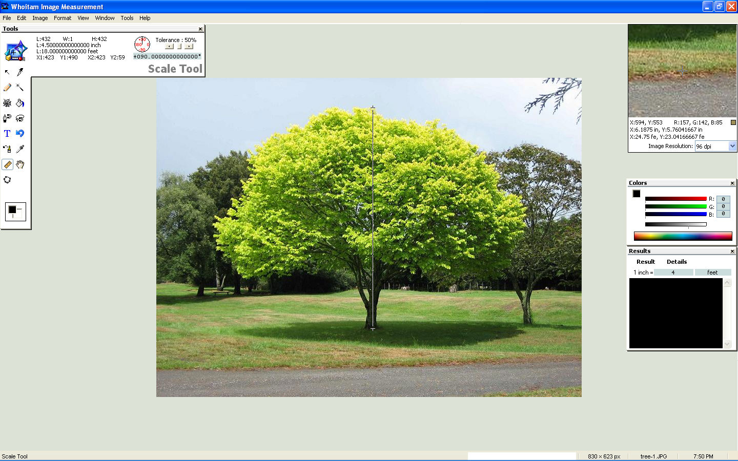
You can get distance between two points by scale tool.
Scale Tool
It can generate a matrix with the decimal values of the image pixels.
Video files and live video can be captured in still image and then measurements can be performed.
Histogram
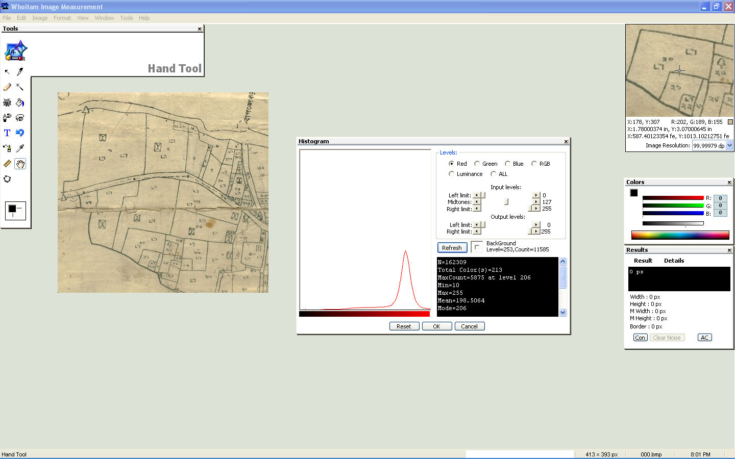
Histogram shows Total Colors, MaxCount, Min, Max, Mean, Mode, Median, St. dev., Mean dev., Variance, Skew, Kurtosis.
You can rotate, merge, flip image. You can analyze image by Pixel Profile.
Merge Image
Pixel Profile
![]()
Whoitam Image Measurement lets you visualize images in a variety of ways, including viewing histograms, generating false color images, merging images, inverting image colors, manipulating channels, applying many filters, adjusting features such as gamma, brightness, contrast, finding, replacing, extracting colors.
You can even count how many objects there are in an image. The interface isn’t hard to get accustomed to.Use the application to easily acquire, analyze, measure, and edit images.
Count Objects

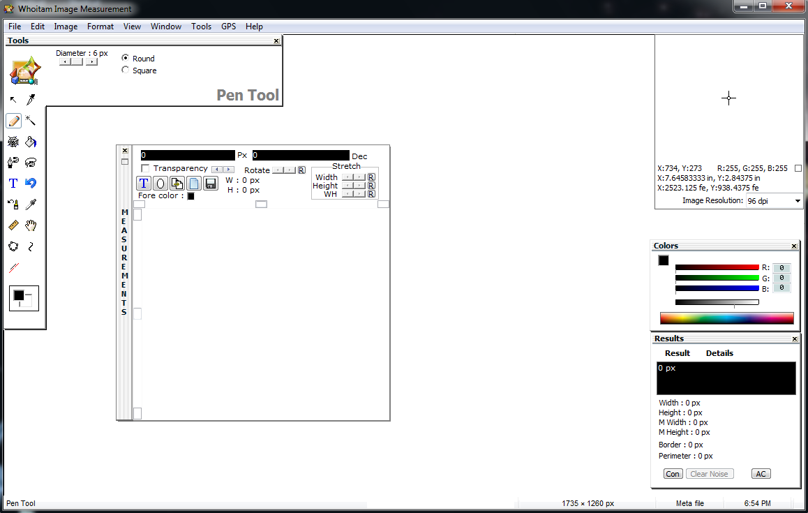
Pen Tool
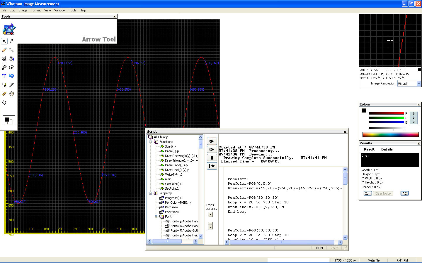
Script
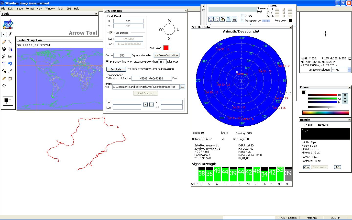
You can visualize GPS Nmea data by Whoitam Image Measurement.
GPS
You will get 3 minutes and 2 magic selection in any time per instance to test this software.
Features :
- Loading different types of images
- Automatic calibration
- Automatically clearing noise in selection
- Zoom, panning, scaling
- Many filters
- Saving view to image
- Fast and selective loading of large stream files
- Measuring distances between two points with angle
- Special Calculator
- Unit Converter
- Geometry calculators
- Drawing images programmatically with script
- Calculating distance by latitude and longitude.
- Advanced histogram
- Adjusting brightness, contrast, gamma, hue, saturation and channel
- Merging images.
- Selecting any irregular shaped region
- Calculating area by polygon tool.
- Counting Objects in image.
- Printing in original resolution
- Painting with round or square cursor
- Pixel profile
- Drawing map using Magnetic Line Tool
- GPS mapping
Whoitam Image Measurement
System Requirement:
- Operating System: Windows 7 (32 Bit)
- Processor: Dual Core or higher
- RAM: 2 GB or more
- Disk Space: 500 MB or more
- Microsoft .Net Framework 4.5 or higher installed from Microsoft website or Microsoft installer