7-Zip is a file archiver with a high compression ratio.
Category: Uncategorized
Powerless Magnetic Pendulum
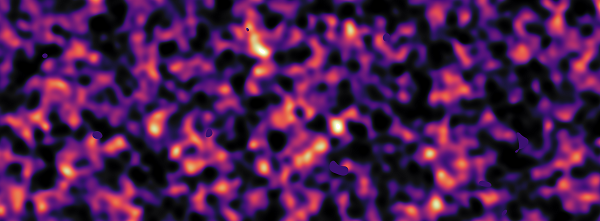
Internet Mapping Project
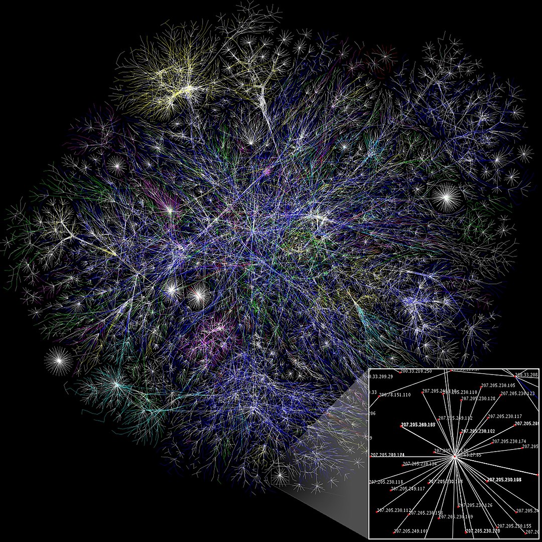
Fig. Internet Map
The Internet Mapping Project was started by William Cheswick and Hal Burch at Bell Labs in 1997. It has collected and preserved traceroute-style paths to some hundreds of thousands of networks almost daily since 1998. The project included visualization of the Internet data, and the Internet maps were widely disseminated.
Dvdisaster
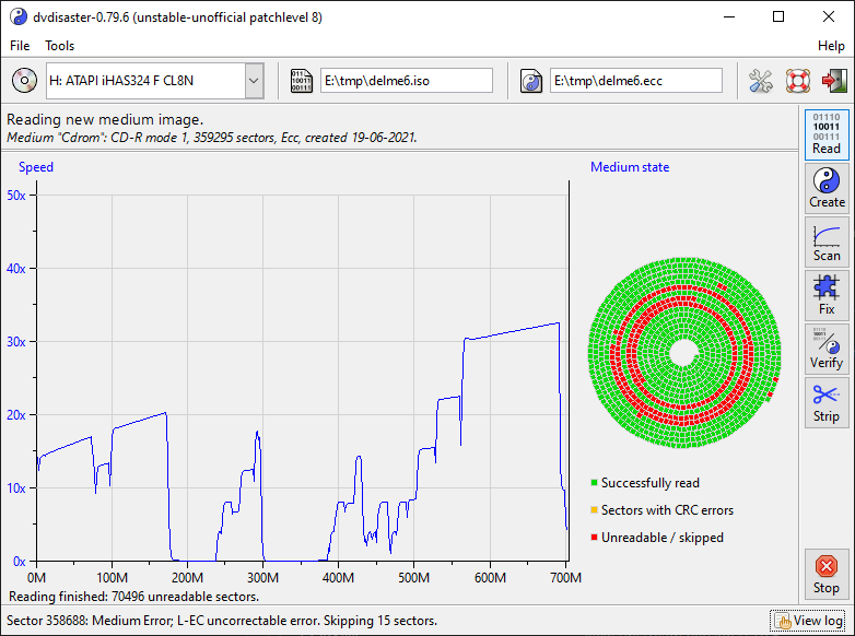
Dvdisaster provides additional ECC protection for optical media. If a medium gets damaged, dvdisaster can recover it as long as the amount of damage is smaller than the amount of ECC data you added to protect it.
The actual movement of our solar system in galaxy
What is Electric power?
Electric power is Volt-ampere. The power used by a circuit component depends on the current and the potential difference across the component. P = V × I where P is power in watts(W), V is potential difference in volts, and I is current in amperes. For example, cars auxiliary power outlets may be rated at 20 A, so that the circuit can deliver a maximum power P = IV = (20 A) (12 V) = 240 W.
What is software decompiler?
A decompiler takes a binary executable, a symbol map (if available), and converts the code into something that can be read as source code.
Matter and Antimatter
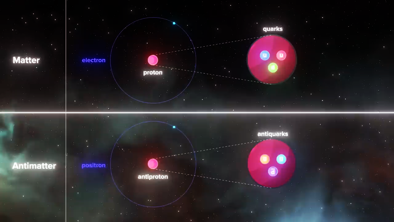
Antimatter, the evil twin of regular matter. Or is it just the misunderstood twin of regular matter. An antimatter particle has charge and other quantum properties compared to its regular matter counterpart. The only thing thats the same is its mass. Except it may be that in at least one sense its mass may be different even opposite to regular matter.
What is dark matter?
Dark matter does not interact with the electromagnetic force. This means it does not absorb, reflect or emit light, making it extremely hard to spot. In fact, researchers have been able to infer the existence of dark matter only from the gravitational effect it seems to have on visible matter.